Tangata whenua of Te Tairāwhiti have been engaging with science and modelling experts to become better prepared for what the future may bring, as extreme weather events continue to prompt the community to find new ways to live with the changing world around them. Both adults and rangatahi are getting involved in environmental monitoring and restoration work, as well as flood prediction and coastal impact assessments.
Current mahi includes:
- Supporting the estuary monitoring programme across Tairāwhiti run by Cawthron Institute & Gisborne District Council. The estuaries in the programme are ecologically important, hold high value to mana whenua and represent differing types of estuarine systems in the region.
- Kakahi Monitoring and learning about deposited sediment and kakahi (freshwater mussel) in Mangaheia river through the Access to Experts programme which connects communities to freshwater experts who can provide guidance and support on everything from nutrients and sediment to wetlands and mahinga kai.
- Supporting the Next-generation Flood Measurement Systems project led by NIWA that promises to bring about substantial improvements in flood measurement accuracy, consequently enhancing the calibration and validation of flood models, which will in turn lead to more effective flood warnings and the improved development of flood protection infrastructure.
- Working with NIWA to capture aerial mapping of the reef in Anaura. The material captured should give whanau an idea of the condition of the moana beds in Anaura, assisting decision-making going forward.
- Working with scientists from NIWA and Auckland University to hold a 2 day wananga at Rongo-i-te-kai Marae, Makarika, for whanau to learn practical skills to better prepare and protect against future weather events. Weather data from different sources showed us what has been happening and what we may experience. The data was also used to display how spatial maps can be used in flood modelling, and how technology such as VR can be used to show this.
- Working in partnership with Huiterangiora Kokiritia!, a group of tane supported and learnt about Kaupapa Wao Taiao (Animal Pest Control). The crew were introduced to biosecurity and biodiveristy monitoring, and learnt how to use a number of different traps and lures, and how to identify pest bite marks on chew cards.
-
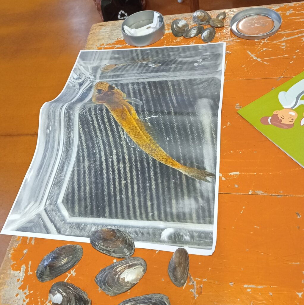
- Ageing Kakahi & the ika the eggs attach to, Monitoring method
-
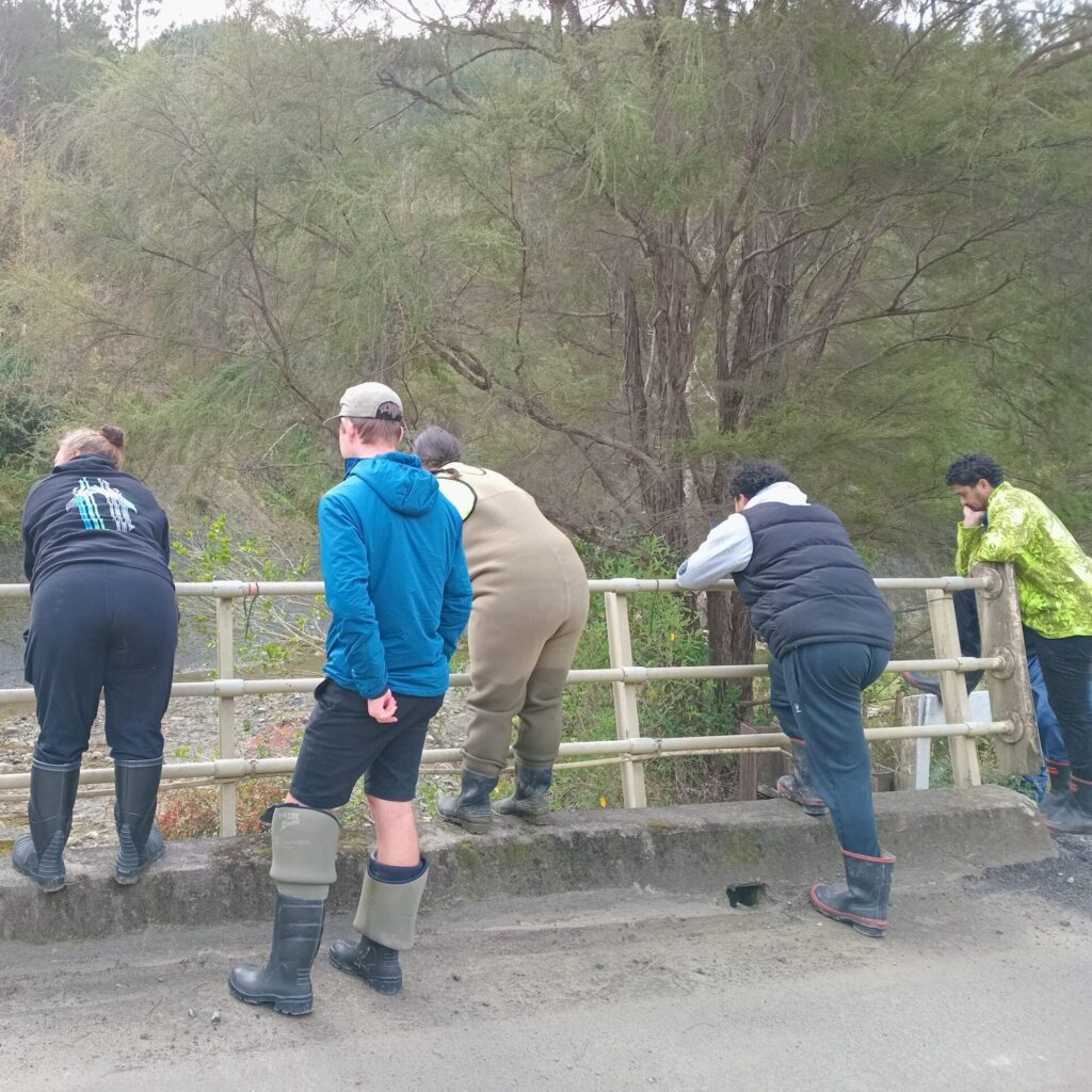
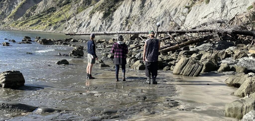
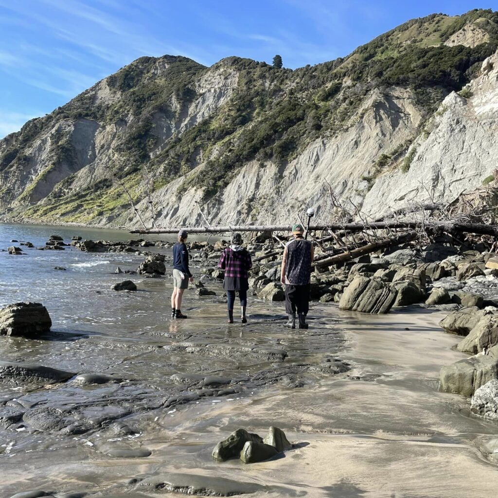
- Checking out the awa as possible sites for Sediment & kakahi testing
-
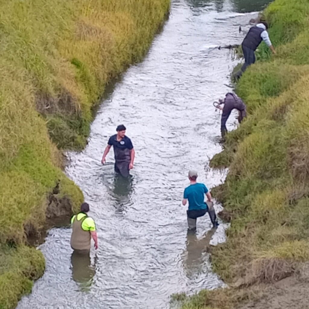
- Searching for Kakahi in the Patiki river. Unfortunately we did not find any live kakahi in the Mangaheia river, a sign of the ill health of the awa.
-
- Anaura: Off to ID any life on the rocks. This material will be used to confirm the material picked up by the drone.
-
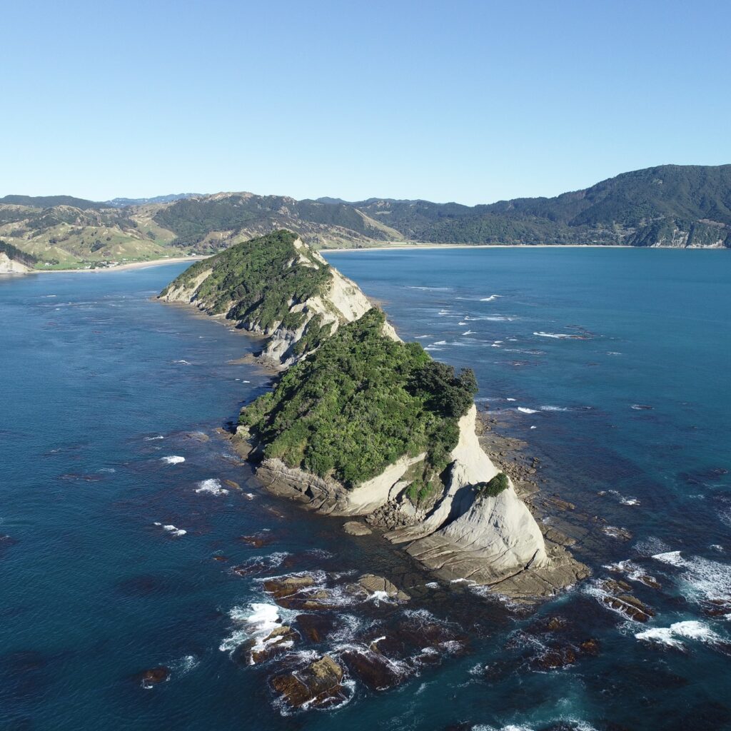
- Anaura: One of the shots that the aerial mapping drone captured.
-
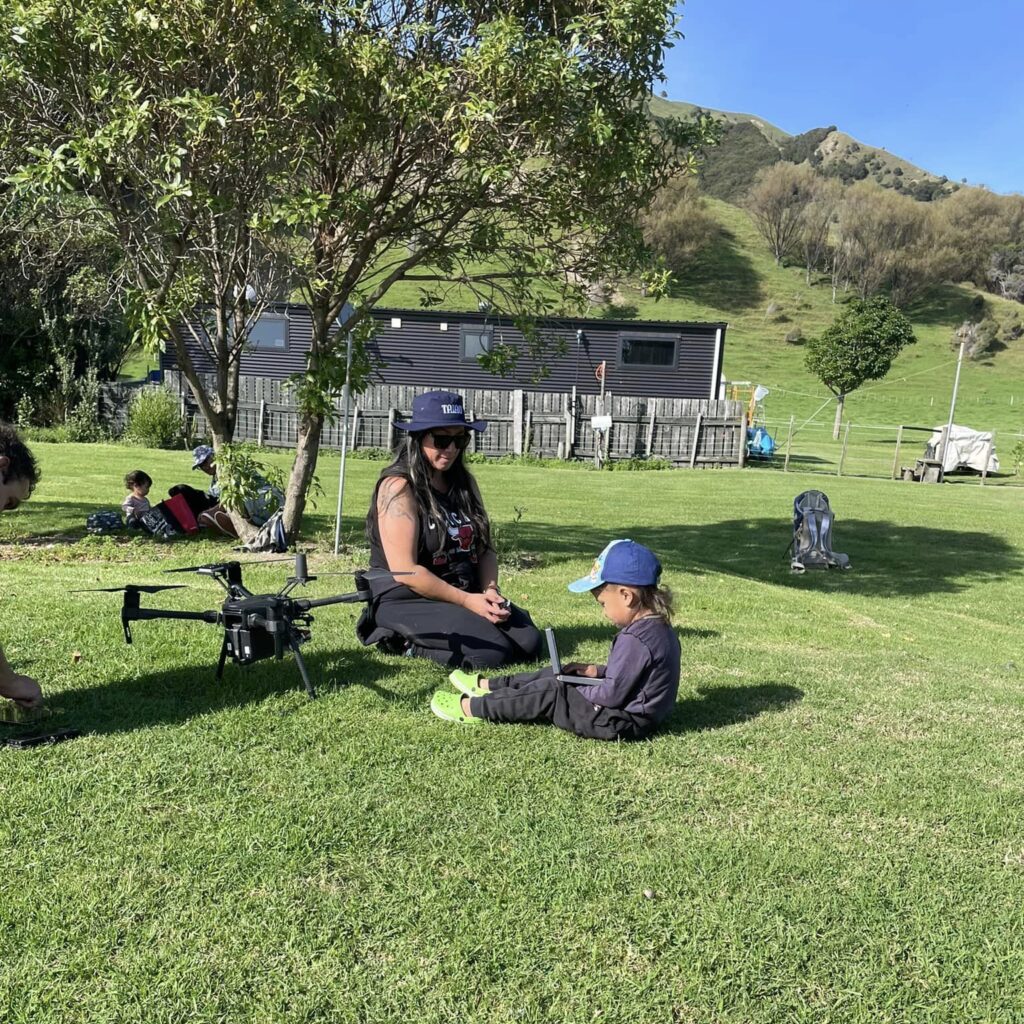
- Anaura: Tawhate ready to fly his first drone
-
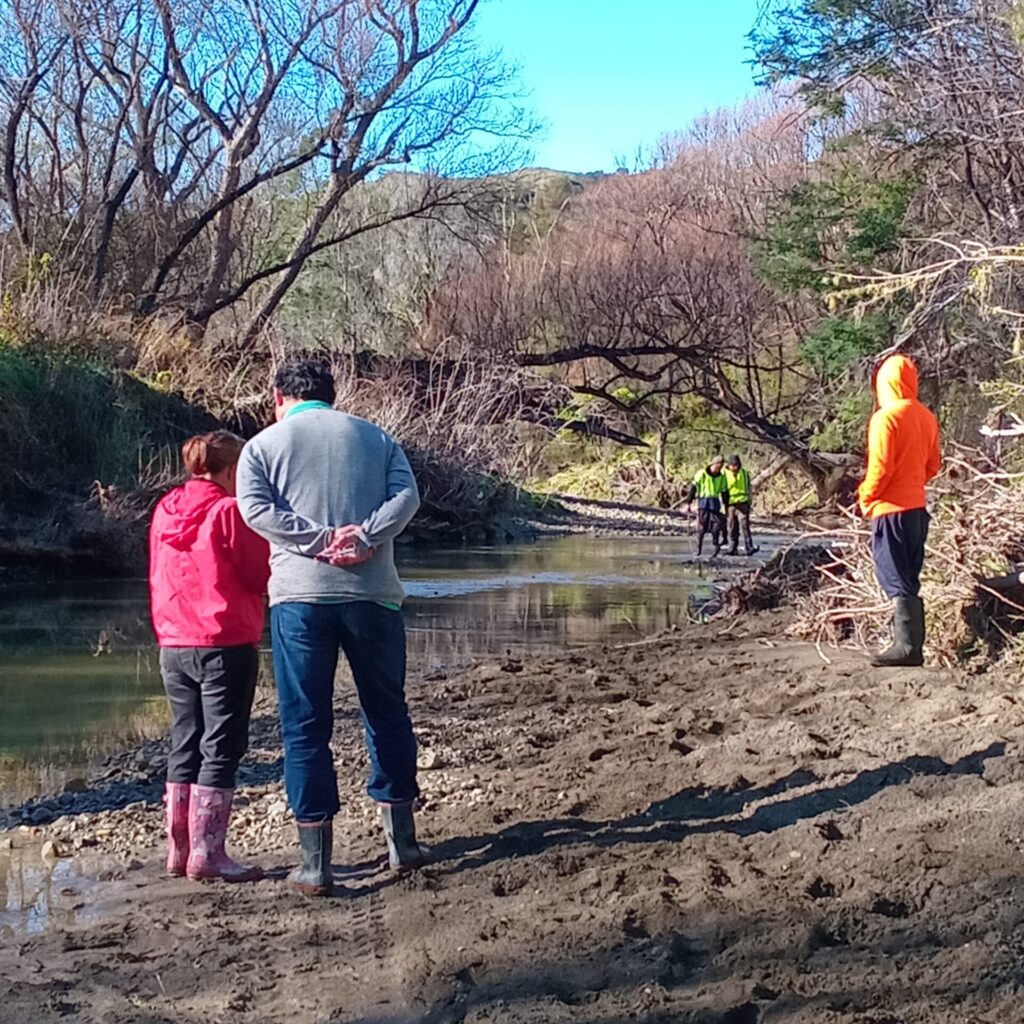
- Makariki. Hikoi to see the impacts of flooding on the Makatote Awa,
-
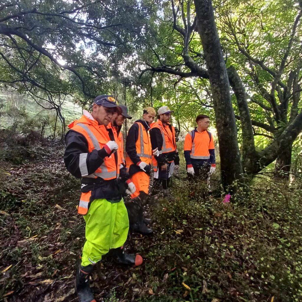
- Kaupapa Wao Taiao – Pest Animal Trapping Waikohu Block ki Whareponga
-
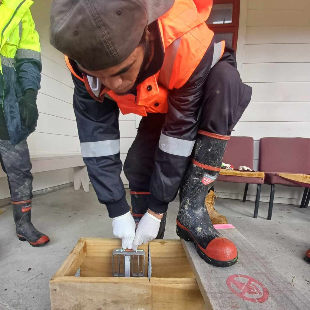
- Kaupapa Wao Taiao -Learning how to set the Doc 200 predator traps
Kaupapa Wao Taiao: “In the lead up Margaret asked that the crew prepare to say their pepeha to the wao (not necessarily ā waha) before entering on the day and that we send through the Tane whakapapa, so that the whanau knew who was coming on to the whenua. This was my standout, definitely a practice to incorporate in to our future kaupapa.”